Resilient Clarence digital map now live
Published on 06 June 2023
The devastating 2019-20 bushfire season was the worst in recorded history for New South Wales. The Clarence Valley was one of the hardest hit areas, with 168 homes destroyed, and many more homes and properties damaged.
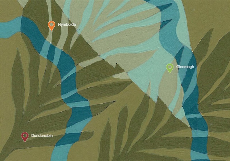
Stories of the bushfires were collected from residents of the ten fire-affected communities of Glenreagh, Ewingar, Nymboida, Dundurrabin, Baryulgil, Malabugilmah, Woombah, Iluka, Ashby and Wooloweyah.
These personal accounts of loss and survival, strength and resilience have been collated into an interactive digital map of the region. The Resilient Clarence Digital Map can be viewed on the surface table at the Grafton Library or on the Resilient Clarence page of the Clarence Valley Council website:

IMAGE 1: Clarence Valley Council Coordinator Community Engagement, Kath Arndell, demonstrates to Creative Director Hayley Talbot and Mayor Ian Tiley how to use the Resilient Clarence Digital Map on the interactive surface table at Grafton Library.
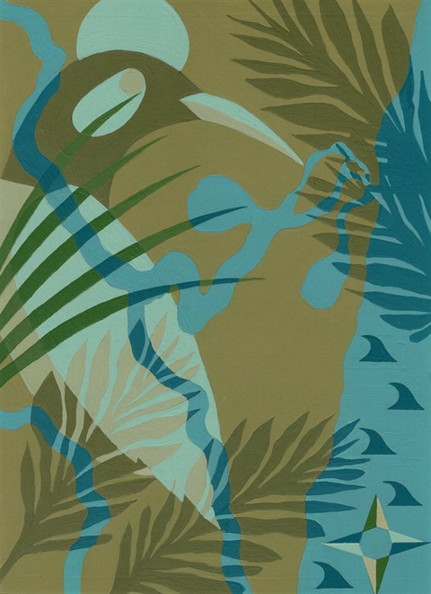
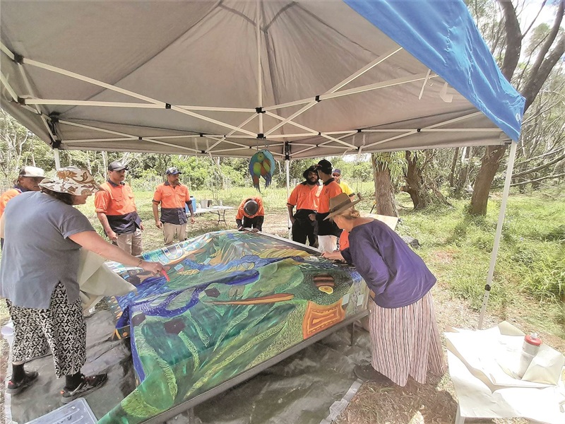
Often, stories are very difficult to share, and it can be difficult to speak on camera. So a creative art activity focusing on emotional healing and recovery was created. The original artwork travelled to each of the bushfire-affected communities and is a collaboration with more than 100 contributors.
The Resilient Clarence collaborative map helped bring community members from Iluka together to share their experiences during the 2019/20 bushfires.
The artwork supported community connection events where people could come together to have a hand in creating the imagery, and to share their stories. Contributions from every community is represented in this artwork.
"Even in a great disaster, beautiful things can evolve"
- Jen, Ewingar
This artwork is currently on display downstairs at Grafton Library, and has been converted into a digital form for the interactive map online. It was facilitated by Kerry Speirs and led by the creative directors engaged to deliver the digital map, Blanc Space Agency.
The interactive digital map features icons that lead to a series of videos from each of the bushfire-affected communities.
The extensive series of videos contained in the Resilient Clarence Digital Map has established a valuable resource other people can learn from into the future.
"It has taken an extraordinary amount of courage for many to share the manifestations of their most harrowing times," Creative Director Hayley Talbot said.
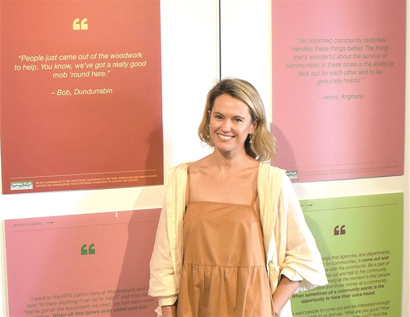
Creative Director Hayley Talbot from Blanc Space Agency led the storytelling and knowledge sharing component of the Resilient Clarence project.
"This project will save lives because of the shared knowledge we have gained.
"Stories are what bind us, teach us and enlighten us, and they are what remains when everything is gone. They live in hearts and minds and can never be taken from us."

The Resilient Clarence Digital Map is an artistic representation of the Clarence Valley region. It is a symbol of home, connection and regrowth.
E-NEWS: Do you want to stay up to date with all the latest news and events from Clarence Valley Council? We issue our newsletter Noticeboard every Friday morning to inform residents and ratepayers on all Council-related issues from the latest Development Applications to a Schedule of Works summarising the latest road maintenance in the Valley. Provide your name and email address here to receive the weekly newsletter direct to your inbox.