Know the flood potential of where you live
Published on 21 December 2021
With a La Niña weather pattern officially declared and localised flooding already experienced in parts of the Clarence Valley, the time to prepare for potential flooding is now.
Clarence Valley Council Director Works and Civil Jamie Fleeting said it was important to understand your risk and be prepared for the unexpected.
“As predicted, we are experiencing an active storm season and a wet start to summer,” Mr Fleeting said.
“While our major centres of Grafton and Maclean are protected by levees that safeguard them from major flooding, we need to be mindful that this doesn’t completely flood-proof these townships.
“There would be serious consequences for these communities if the levees were to fail or overtop. To minimise the risk, we regularly inspect urban levees and undertake any identified maintenance works to ensure levee integrity.”
Mr Fleeting said flood pumps were also tested monthly as a part of our routine maintenance schedule.
“When the Bureau of Meteorology (BOM) issues a “Flood Watch” for the Clarence River, we check all flood pumps are operating correctly and that floodgates in urban areas are free of debris and sealing properly,” he said.
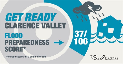
“Research undertaken by the Jetty Institute last year showed Clarence Valley residents were, overall, complacent about flooding.
“In order to best prepare, it is important to understand what consequences occur at different river heights and what action you can take to keep yourself and your property safe,” Mr Fleeting said.
“Many communities and properties in the Clarence Valley become isolated during flood events as access to roads is cut. It is important that we all heed the warnings from the Emergency services and don’t drive through floodwater.”
"Links to live flood monitoring cameras are available on the Clarence Valley Council website, with five key locations currently being monitored. New cameras are being installed at Harwood Bridge and Palmers Channel on Yamba Rd, McFarlane Bridge, Lawrence Rd and Wolli Rd. They will be live by the end of 2021."
To help with planning and preparedness, the SES has developed a localised resource with information about how flooding affects different communities in the Clarence Valley.
Find out more about how your community may be affected and how you can prepare.